The family and I recently spent a very enjoyable week on holiday in Kielder Water & Forest Park in Northumberland. The Park is home to the biggest man-made lake in northern Europe and the biggest working forest in England. It covers 250 square miles and is located circa 50 miles north west of Newcastle just south of the Scottish border.
One of my goals for the holiday were to get some mountain biking miles under my belt and I had done a fair bit of research on the trails before the holiday. I was also resigned to doing the biking on my own as the routes would be too much for the other family members. The map below shows the trails in the area.

There are a good number of trails and lots of information is included on the Visit Kielder Website.
On the Monday morning I did the Bloody Bush Trail, on Wednesday morning the full Lakeside Way Trail and on Thursday afternoon the Lonesome Pine Trail. All were excellent and further details follow:
Bloody Bush Trail
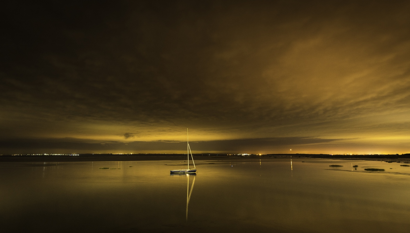
I got up really early on the Tuesday to do this trail having got all prepared the night before. I was up at 5.30am as I wanted to also photograph and timelapse film a sunrise. As it happened the Tuesday was the best day of the week to do this – which was good. An album of photos of the sunrise can be found here and the timelapse can be found here.
The trail map for the Bloody Bush Trail is included below. Click on the image opens a bigger version in a new window. The original pdf can be found on the official visit Kielder website here.

As this was my first major ride for a while and in the area and I didn’t quite know what to expect I decided to not do the full ride including parts of the Lonseome Pine trail. Instead I parked the car at the Lewisburn car park and rode from and back to there. The car park was empty and quite remote and I was a little nervous about leaving the car there unattended – but I did and it was fine.
I togged up and cycled up the forest road to Akenshawburn where the trail headed off to the right and up the hill – still on forest road. This led up to ‘Simon’s Tester’ which was a steep uphill sequence of switchbacks which you just had to grind up. At the top the trail rejoined the forest road for a gentle uphill then long downhill section before turning left and back up hill to the base of ‘Stoney Holes’ which is anorther steep uphill switchback section. This led up onto the heath and onto a section of boardwalk they call ‘Northshore’ onto the ‘Stairway to Heaven’ The views over Kielder Water from up by the Lonesome Pine were superb.
Up at the lonesome pine (that you can see from miles around) the boardwalk trail either goes left on the Bloody Bush Trail or right to head back down to Kielder castle on the Lonesome Pine Trail. On this ride I went left.
The trail then continued in part on boardwalk (narrow in places) but mostly as singletrack along the ‘Borderline’ section in the trees which is passes into Scotland. The singletrack is straightforward and nearer the end of this section gently uphill and very rough.
At the end of ‘Borderline’ the trail turned left and out of the trees into an area that was forest but has been felled in the recent past. As such it is quite barren. This section named ‘The Final Countdown’ is a long gently downhill section with banked turns and small dropoffs and quite rough but good fun and good for practising technique. In a few places I nearly came off the track but avoided crashing out into peat bog, stumps and logs.
At the end of ‘The Final Countdown’ the train joins the cross border track and turning right it is only a short uphill ride to the border marker monument where I stopped to take in the views and to have a snack. On the whole ride up to this point I saw not one solitary sole.
After a rest I took the cross border trail back down all the way to the Lewisburn car park. The trail started as overgrown track but soon turned into decent forest road and the decent was maybe 5km long which was fun after the relatively tough climbing. I stopped a few times on the way down to take some pics and did think to myself on the decent that I could see why the RAC rally used to have stages in Kielder in years gone by (may still do?).
The whole route above took just over 2hrs 30mins which included a fair amount of time stopping to take photos and the like but not including the stop at the border monument. All in all it was an excellent introductory ride which encouraged me to do more trails whilst I was on holiday. The Lonesome Pine trail (about which I hope to write another blog) was tougher and had more technical decents.
A runkeeper track of my route can be found here although it went a bit AWOL up near Scotland – but it gives the idea and allows you to see the route(ish) on the aerial photo. You can view an album of photos taken on this ride on my Picasaweb website here plus and a few photos from the trail are also included below. Clicking the the photos opens a larger version in a new window.


